Wolverine Area Lodging

Updated 7/20/12

The event location is just south of Wolverine. Boyne Falls is west of camp, about 15 miles. Indian River is north of Wolverine and has numerous motels about 22 miles. Gaylord is south of Wolverine and about 23 miles from camp.
Those that we think are closed are shown as strikethrough

Motels/Hotels/Cabins:

Wolverine –

Malone’s Sturgeon River Cabins
http://www.malonescabins.com/
231-525-8890

Silent Sport Lodge
http://www.silentsportlodge.com/
231-525-6166

Walloon Lake –

Dickson’s Lodge
http://dicksonslodge.com/
231-535-2415

Boyne Falls –

Sleepy Fawn Motel
(231) 549-2663

The Brown Trout Motel
http://www.browntroutmotel.com/
1-888-609-7261

Four Seasons Motor Lodge
http://www.fourseasonsmotorlodge.net/
(231) 549-2710

Gaylord –

Holiday Inn Express
www.hiexpress.com
(888) 400-9714

Best Western
http://www.bestwesternmichigan.com/hotels/best-western-alpine-lodge/
(989) 732-2431

Baymont Inns & Suites Gaylord
http://www.baymontinns.com/Baymont/control/Booking/property_info?propertyId=17819
(989) 731-6331

Indian River –

Hometown Inn
http://www.irhometowninn.com/
888-255-3365

BRENTWOOD LODGING
http://www.brentwoodlodging.com/
800-880-3440

Coach House Motel
http://www.coachhousemotelir.com/
231-238-9370

Silent Sport Lodge B & B
http://www.silentsportlodge.com/
231-525-6166


Vanderbilt –

Closest motel we are aware of, but has not had stellar reviews by our members:
Elkland Extended Stay‎
7591 Old 27 Hwy N, Vanderbilt, MI – (989) 983-3201


More information:
info@gldsmc.com
Jeramey @ (989) 751-6863

GLDSexMi Reports

GLDS Expedition: MichigantheCourse

Reports


Great write-ups and photos galore from previous runs.

Much of the upper peninsula uses areas well covered from the UP Dual Sport Safari and the CannonTrek.

Bryan Much has arguably the best ride reports going. See his 2008 CannonTrek (UP) and 2008 GLDS Expedition Michigan (LP) on ADVrider.com.

Interactive Photo Map covering both LP and UP. Photo gallery as well (thanks to Bryan for use of his photos).

Images by Bryan Much

GLDSexMi FAQ

GLDS Expedition: MichigantheCourse

FAQ


Q. What’s this “bikes bigger than a 650L will test the rider” stuff?

A. Michigan has lots of sand, if you want off the pavement, plan on riding sand, ruts and other types of technical riding that is much easier done on a smaller/lighter bike. We hope to rate each section to make it easier to decide what’s OK for you and your ride.

Q. Do I need a GPS and which one should I get?

A. Yes and Garmin, mapping unit. 60CX is very popular with our crowd. The files are universal and you should be able to get them to work with most any unit, some easier than others. Some units do not handle tracks very well (Nuvi, Zumo) or at all (StreetPilot). You’ll need to convert the tracks to routes to use the data.

Q. What tires should I run?

A. DOT approved knobbies. Your choice. Pirelli Scorpion Pro in the front and a Kenda TrackMaster K760 in the rear is a good combo. Central and Western UP is more rocky, the rest is pretty sandy. Put another way – less air pressure in sand, more in rock.

Q. I have the CD, can I make copies of it for my riding friends?

A. Yes. Long as you are not selling/bartering/trading the copies (ie for commercial purposes).

Q. I don’t want to print out all the maps, or they take too long to download. What can I do?

A. See the VVMapping partner product on the download page.


GLDSexMi Help

GLDS Expedition: MichigantheCourse

Help


Easy part first, the maps. The maps are PDF files, you’ll need the free Adobe Reader program from Adobe to see/view/print the maps. These maps are high quality, full color jobbies and include ORV trails, public land, county roads, gas stations and more. The main map set is a big download (150+ MB) and is not good for folks on dial-up. You should save the file (right click and Save Link As) and save the file to your computer, then open it.

Next up are the GPS files. These are track logs that we’ve created. There are a “core” set of tracks, named “GLDSEXMIUP” or “LP” depending on if they are for the upper peninsula or lower. The other tracks are named for the area/town/funny story related to them. The other tracks are options. They are what you can use to make smaller loops, connectors or whatever.

There are no “routes”. You will need to make your own based on these tracks or do a “track back” if your GPS supports that feature. Tracks just show as a colored line on your GPS, like a highlighted road on a paper map. They don’t tell you which way to go, just show you.

Waypoints are included for gas stations. We didn’t include lodging/camping information with the first release, let us know if we should include it.

Many GPS units have a limit on the number of tracks they can hold. Modern Garmin units of the mapping/outdoor variety (60CX) can hold 20 tracks at a time. This means you will need to know what your GPS can hold as well as delete some of the tracks from the file on the computer before sending to your GPS.

To make things a little easier, we have offered up a couple varients of the GPS files. First, we have “native” Garmin files (GDB); next we have “universal” files (GPX). If you have Garmin, then go for that, if not, get the GPX file. Best bet is to right click and “Save Link As” and save the file to your computer.

We also offer files with the “extras” already removed. If you are not so sure you can load your GPS let alone delete the extra tracks (the optional courses) then we have files that have just the core files or just the optional pieces.

Finally, if you can’t download the files (connection is too slow or whatever) or don’t want to spend the $$ printing your own maps, you can get a CD and a hard copy of the maps (wire bound booklet) through VVMapping; see link on download page.


GLDSexMI File Downloads

GLDS Expedition: theCourseMichigan

Files

You may not sell or otherwise use these files for commercial purposes. This includes using them as part of an event.

There are files for your GPS (track logs) and maps (PDF) linked below. No route sheets.


You accept all risk and liability associated with the use of these files and the navigation of any suggested routes therein. Only paths legal and open to the public were used originally – but things change and we do not monitor these routes. Roads close, bridges wash out, property changes hands, new rules are implemented and who knows what else (we sure don’t know). Don’t trespass. Don’t ride over your head. Be alert and stay safe. These suggested routes are open to the public and that means oncoming cars, washed out hills, hidden hazards and all kinds of other potentially nasty stuff. By following these routes you agree that it’s up to you and you alone to stay safe and legal and that we (GLDS, etc.) are not in any way liable for any misfortune that you cause or receive.

I agree to these terms (click to accept and download GPS – Garmin format) 1MB

I agree to these terms (click to accept and download GPS – GPX format) 2MB

I agree to these terms (click to accept and download Maps ALL) 112MB

Too much confusion with all the tracks? Choose below for just the main tracks or just the optional tracks.

I agree to these terms (click to accept and download GPS – Garmin format NO OPTIONS) 1MB

I agree to these terms (click to accept and download GPS – GPX format NO OPTIONS) 2MB

I agree to these terms (click to accept and download GPS – Garmin format JUST OPTIONS) 1MB

I agree to these terms (click to accept and download GPS – GPX format JUST OPTIONS) 2MB

Single map file too large to download? Try just the LP, UP or page locator:

I agree to these terms (click to accept and download Maps LP) 74MB

I agree to these terms (click to accept and download Maps UP) 91MB

I agree to these terms (click to accept and download Maps LOCATOR) 1MB

I agree to these terms (click to accept and download Maps COVER) 13MB

Right Click and Save Link As

Help page with information on files and what to do with them

For those that need a CD with the files on it plus printed maps, we have a partnership with VVMapping to provide a physical product for the low price of just $30. It includes all the GPS and Map files plus a printed map book of the routes. Product Details and Store Link.


GLDS Expedition Michigan

GLDS Expedition: MichigantheCourse

3500 Miles. Dual Sport Heaven. Dozens of Loops & Options. Free Download.


3500 miles of Michigan’s fantastic Dual Sport riding. Big loops, little loops and linear options. Ride as much as you want, how you want.

There are two main loops, one in the LP for 1100 miles and the other in the UP for another 1000 miles. There are 1500 additional miles of options. You can combine them in any way that serves your needs – from an 100 mile, single day loop on up to a couple thousand mile, week-long adventure. The area covered includes most of the UP as well as a good half of the LP.

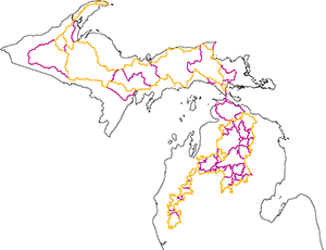
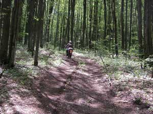
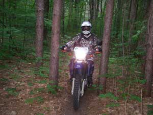
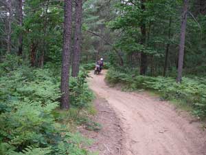
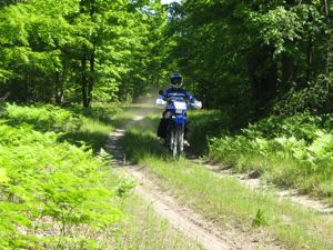
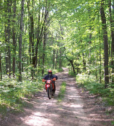
Want to spend a week riding one big loop in the lower peninsula? No problem.
Want to spend a day riding which loops back to your truck? No problem.
Want to camp from one location and ride different stuff for 3 days, coming back to camp on each day? No problem.

These routes are straight from GLDS’s playbook. Think of it as just a taste of what our rides are like, and yes, our events have even more “good stuff” than you’ll encounter while on this expedition. Here’s your chance to experience Michigan Dual Sport riding the way we love, but at your pace and your schedule.

It’s mostly two track with some road connectors and the regular pavement sections to get to gas stations plus an occasional stretch of single track.

You will need a street legal bike with knobby tires. Plus a GPS. And an ORV Sticker.

The terrain and course was targeted at a DRZ400. Anything bigger than a 650L will test the rider’s ability.

Camp it. Motel it. Campground it. Day Trip it. All up to you. We figure two weeks straight riding to cover it all and doubt any mortal can do so.

GPS data and the maps are offered up here for download. Free. No membership needed (but, hey, if you want to join it’s only $10).

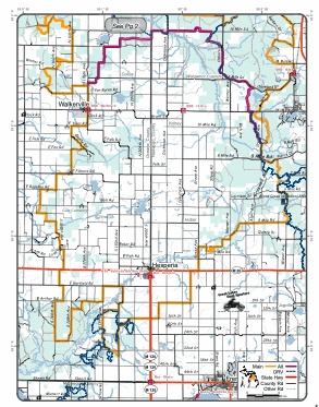
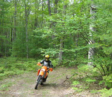
Download and load up your GPS, fire up your printer and crank out the map pages that you need.

For those that need a CD with the files on it plus printed maps, we have a partnership with VVMapping to provide a physical product for the low price of just $30 (see download page for link).

You may not sell or otherwise use these files for commercial purposes. This includes using them as part of an event.


You accept all risk and liability associated with the use of these files and the navigation of any suggested routes therein. Only paths legal and open to the public were used originally – but things change and we do not monitor these routes. Roads close, bridges wash out, property changes hands, new rules are implemented and who knows what else (we sure don’t know). Don’t trespass. Don’t ride over your head. Be alert and stay safe. These suggested routes are open to the public and that means oncoming cars, washed out hills, hidden hazards and all kinds of other potentially nasty stuff. By following these routes you agree that it’s up to you and you alone to stay safe and legal and that we (GLDS, etc.) are not in any way liable for any misfortune that you cause or receive.

I agree to these terms (click to accept and proceed to download page)


MBAS File Downloads

Manitou Beach Area Adventure Ride Series DOWNLOAD PAGE

Files

You may not sell or otherwise use these files for commercial purposes. This includes using them as part of an event or another web site.

There are files for your GPS (track logs) and maps (PDF) linked below as well as route sheets (PDF). The Route Sheets are both letter sized (cut and tape the strips) and “thermal” for those with a printer capable of printing 2.25″ wide continuous paper.

You accept all risk and liability associated with the use of these files and the navigation of any suggested routes therein. Only paths legal and open to the public were used originally – but things change and we do not monitor these routes. Roads close, bridges wash out, property changes hands, new rules are implemented and who knows what else (we sure don’t know). Don’t trespass. Don’t ride over your head. Be alert and stay safe. These suggested routes are open to the public and that means oncoming cars, washed out hills, hidden hazards and all kinds of other potentially nasty stuff. By following these routes you agree that it’s up to you and you alone to stay safe and legal and that we (GLDS, etc.) are not in any way liable for any misfortune that you cause or receive.

Tri-State Adventure Ride:

GPS: I agree to these terms (click to accept and download GPS – Garmin format)
Map: I agree to these terms (click to accept and download Map – PDF format)
Route Sheets Thermal: I agree to these terms (click to accept and download Route Sheet for 2.25″ paper – PDF format)
Route Sheets Cut/Tape: I agree to these terms (click to accept and download Route Sheet for letter paper – PDF format)

102.5 Miles – 55% Gravel 45% Paved
Make a Run for the Borders Where You can Park Your Scoot in Michigan, Indiana and Ohio at the Same Time.
Pass Through the Heart of Amish Country and Roost Your Buddy with Horse Apples.

Fox Run Adventure Ride:

GPS: I agree to these terms (click to accept and download GPS – Garmin format)
Map: I agree to these terms (click to accept and download Map – PDF format)
Route Sheets Thermal: I agree to these terms (click to accept and download Route Sheet for 2.25″ paper – PDF format)
Route Sheets Cut/Tape: I agree to these terms (click to accept and download Route Sheet for letter paper – PDF format)

30.3 Miles – 55% Gravel 45% Paved
1950’s Era Replica Gas Station – Cherry Lane Nudist Resort – Iron Mustangs MC Clubgrounds
Plus the Site of Sawdey’s MX and 4 Hour Enduro Races in the 1970’s Are Some of the Sights Along the Way

Devil’s Lake to Hell & Back Adventure Ride:

GPS: I agree to these terms (click to accept and download GPS – Garmin format)
Map: I agree to these terms (click to accept and download Map – PDF format)
Route Sheets Thermal: I agree to these terms (click to accept and download Route Sheet for 2.25″ paper – PDF format)
Route Sheets Cut/Tape: I agree to these terms (click to accept and download Route Sheet for letter paper – PDF format)

127.16 Miles -70% Gravel 30% Paved
Yes, There is a Hell, Michigan …and You Can Get a Tee Shirt to Prove It.
You’ll Ride Hills, Twisties and Pass Through Tunnels of Tree in Heavy Woods to Get There!


Right Click and Save Link As

Manitou Beach Adventure Series

Manitou Beach Area Adventure Ride Series

– Miles of Smiles on Scenic Gravel Roads &Secluded Blacktop –
Plenty of Paved Parking and Restroom at Public Access on Devil’s Lake

DIRECTIONS:
US 223 to Flashing Light at Devil’s Lake Hwy
South 2.7 Miles to Paved Entrance of Devil’s Lake Public Access
N 41 56.908 – W 18.623

Legal:
These courses use County and State/Federal Highways. A street legal bike and rider are required.

Tri-State Adventure Ride (download):
102.5 Miles – 55% Gravel 45% Paved
Make a Run for the Borders Where You can Park Your Scoot in Michigan, Indiana and Ohio at the Same Time.
Pass Through the Heart of Amish Country and Roost Your Buddy with Horse Apples.

Irish Hills Scenic Adventure Ride (download): 
89.84 Miles – 64% Gravel 36% Paved
Rolling Terrain Through Some of the Best Backroads in the Irish Hills Area.

Fox Run Adventure Ride (download):
30.3 Miles – 55% Gravel 45% Paved
1950’s Era Replica Gas Station – Cherry Lane Nudist Resort – Iron Mustangs MC Clubgrounds
Plus the Site of Sawdey’s MX and 4 Hour Enduro Races in the 1970’s Are Some of the Sights Along the Way

Devil’s Lake to Hell & Back Adventure Ride (download):
127.16 Miles -70% Gravel 30% Paved
Yes, There is a Hell, Michigan …and You Can Get a Tee Shirt to Prove It.
You’ll Ride Hills, Twisties and Pass Through Tunnels of Tree in Heavy Woods to Get There!

CAMPING:
Irish Hills Campground, US 12 near Cement City (517) 592-6751 www.campingfriend.com/IrishHillsResortKampground/
Juniper Hills Campground, US 12 near Michigan International Speedway (517) 592-6803

MOTELS:
Clearwater Resort, US 12 on North Shore of Devil’s Lake (517) 547-7472 www.devilslakemich.com
Motel Somerset, (517) 547-7241
Super 8 Hotel, Brooklyn (517) 592-0880

MOM & POP EATERIES (Breakfast and Lunch)
Tina’s Kitchen, Downtown Manitou Beach
The Shores, Downtown Manitou Beach
Jus’ Bad Food, Brooklyn
Poppa’s Place, Brooklyn

LOCAL EATERIES (Lunch and Dinner)
Manitou Beach Bar & Grill, Corner of Devil’s Lake Hwy and Walnut Street
Highland Inn, Between the Lakes on Round Lake Hwy
Captain Chuck’s, US 223 near Devil’s Lake Hwy
Artesian Wells Sports Tavern, US 12 near US 127
Harold’s Place, Corner of US 12 and Onsted Hwy

PLACES OF INTEREST:
Michigan International Speedway, US 12 near M 50
Town & Country Sports Center, US 12 near US 127 (large motorcycle showroom with mini museum)
50 lakes within 10 miles

MOTORCYCLE REPAIR:
Rocky’s Recreational Repair, Downtown Manitou Beach
Moto 1 Cycle, US 223 near Onsted Hwy www.moto1cycle.com
Holiday Powersports Page Avenue in Michigan Center (517) 764-3600 www.holidaypowersports.com
Dexter’s Inc. M 52 south of US 223 in Adrian (517) 263-6050

Ted’s Chandler Hill Challenge 2012

AMA National Dual Sport

Note: NEW DATE!:  August 18-19, 2012, Wolverine Michigan

Register by mail
Event Flyer & Mail-In Registration Form (pdf)

Register ONLINE
Pay with credit card or PayPal

Online payment has ended, can still sign up on site.

Some of Michigan’s best motorcycle-only single track mixed in with some of the finer remote two tracks flowing through great elevation changes (hey, it’s Michigan, stop laughing) with gobs of summer green in full swing.

TCHC10logoThis is a route sheet ride, we can load your GPS and you will get a map. The route is not arrowed. Navigation is part of the experience.

There’s the “regular” high quality Dual Sport route that a DRZ400 is perfect for. Then there’s the hero sections mixed in with the Dual Sport that may be more suited to the sporty two-stroke lover in you.

Separate Adventure Tour routes available for the larger 2 wheel machines.

Main hero sections will be optional. Make the Dual Sport route as challenging or as easy as you want.

Michigan is sandy country, street legal knobby tires are strongly encouraged for all bikes, big or small.

Participants can experience both days or just one.
Gas stations are located directly on the routes.

Street Legal bikes and riders only. 94db max strictly enforced. ORV Sticker required for Dual Sport ($16.25, available online from the MI DNR; some available at event)

August 18th & 19th, 2012
Wolverine, Michigan (approximately 2 miles south of Wolverine, Michigan)

120 miles on Saturday with another 90 for Sunday. Shorter options available.
Route Sheets, Maps and GPS data provided at Registration.

Lunch will be provided on Saturday right on the route. Dinner at Camp on Saturday night is also included.

Door Prizes provided on Saturday after dinner.

Event is staged at Sturgeon River Campground (Facebook link), also known as Sturgeon Valley Campground (new website) – new phone number for 2012 as well: 231-525-8301. Reservations are welcome, but not required. Make sure they know you are with the event.

This ride is “Ted’s” ride, as fellow club member and former lead dude for this event, Ted Farnsworth, passed away suddenly just weeks before the ride in 2009.

Photos Here and Here & Here from the 08 routeVideo from the 08 RoutePhotos from the 07 routeVideo from parts of the 07 courseCheck out our Sponsors!:Sicass Racing


Local motels available.

Preregister & Save! $35 for 1 Day, $65 for both; $40/Day when paid at time of event.
Preregistration bonus! Free Event T-Shirt included for all pre-paid riders!! Preregistration ends August 15th. You can still register & pay at the event after the 15th.

Technical inspection and registration Friday 7:00 PM to 8:30 PM, Sat/Sun 8AM to 10AM

Directions:

Map available to site

I-75 to exit 301 (Wolverine).
West on Main St to Ballard (bottom of hill)
Left/South on Ballard 0.1 miles to Coffron (aka Trowbridge)
Left/South on Coffron/Trowbridge for 2.2 miles to Sturgeon River Campground (on left/east side).

More information:
info@gldsmc.com
Jeramey @ (989) 751-6863


View Larger Map

Club Ride #6 2012

Club Ride #6

Club Ride, July 28-29, 2012. Mancelona, MI


el Bob

This is a Club Ride, it’s not an event. There are no entry fees, no donations, no membership requirements, nothing. Just come ride with a few fellow Club members. Don’t worry about crowds – these are small, social functions. We also provide dinner on Saturday night. Feel free to bring a dish to pass, but don’t feel obligated.

Two loops. Street legal bikes only – NO direct trail access from here for unlicensed bikes (county roads are open to ORVs).

Details in our forum (Members Only). Want to check out GLDS; not a member yet? Email us for more information.

Private camground, reservation recommended. Motels in Mancelona close by.